traffic engineering
|
|
Prepared for: KORS (keep our roads safe) |
Placer County
near auburn, ca
Traffic Study Review for Hidden Falls Regional Park Expansion SEIR
|
|
| traffic_review_report_for_kors3.pdf |

|
VIDEOS of TRAFFIC taken by Grant P. Johnson, Traffic Engineer
|
“SIMTRAFFIC MODEL: Bell Road at Joeger Road During Wildfire Evacuation.” |
|
|
Horse Trailer, Large Vehicles, and Narrow Road Alignment and Sight Distance Constraints |
|
In this narrated video, several scenarios are depicted to illustrate the various roadway constraints that exist on roadways that would be considered exit routes to get to the S.R. 49 Highway in case of an evacuation. Currently, there is very limited capacity to carry large volumes of traffic, especially with large and long vehicles in the mix. This limited capacity means long delays, and in the case of a fire, this would be a very dangerous situation where safety is compromised.
|
|
|
Aerial View of Traffic Count at:
|
Traffic Count Sample at:
|
|
TRAFFIC SAFETY ISSUES in the Hidden Falls Regional Park Vicinity.
|
|
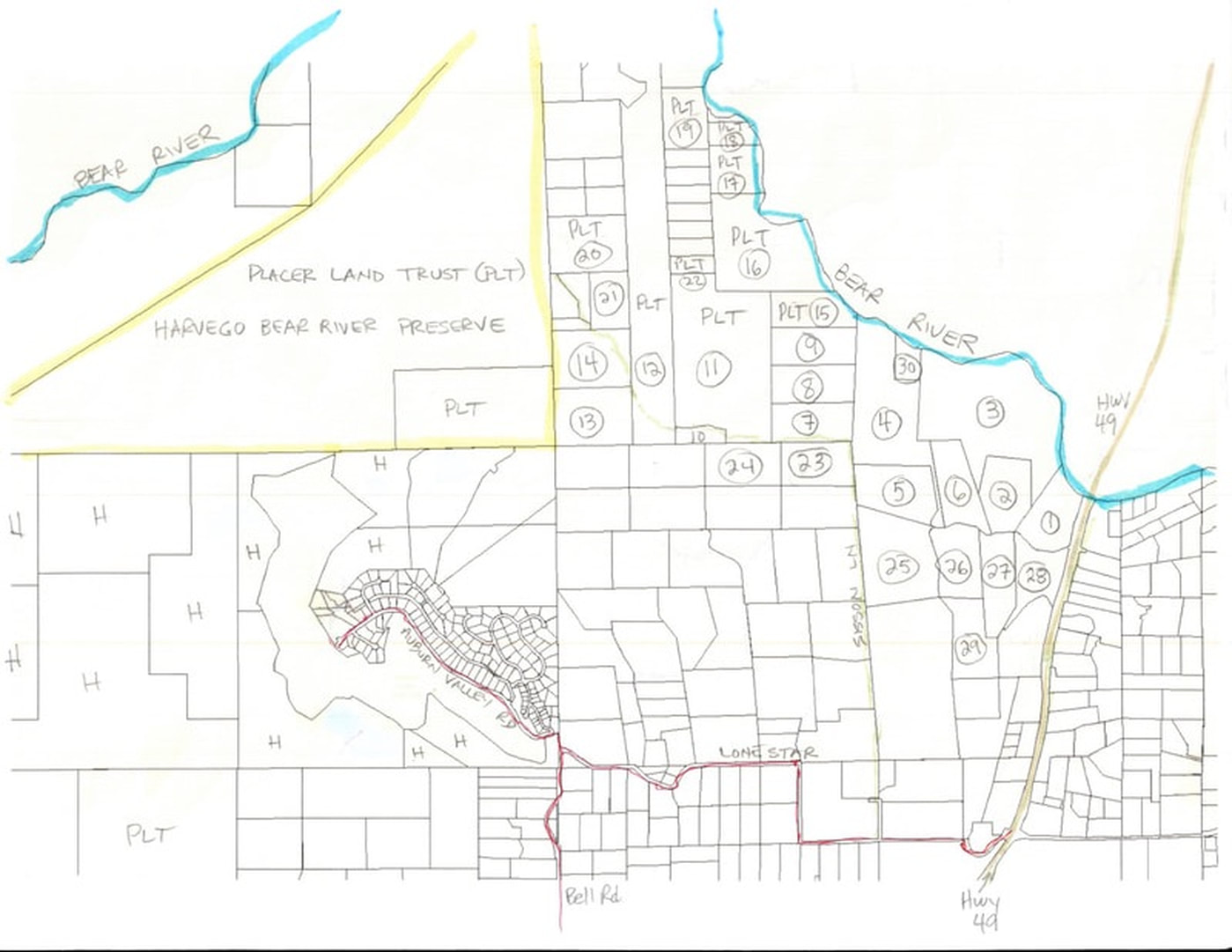
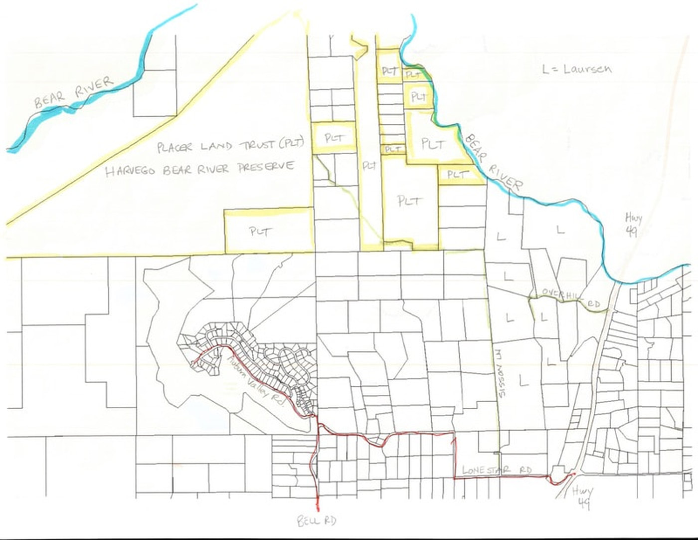
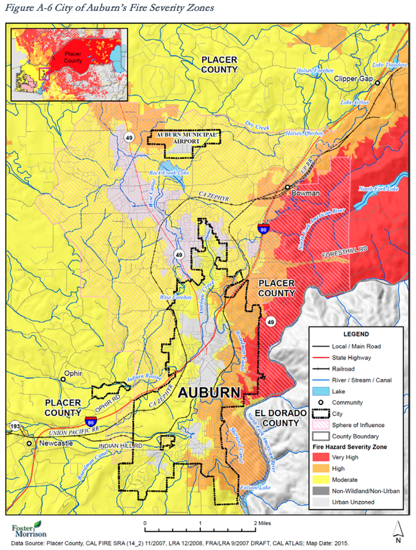
Fire Risk in the area of Placer County north of Auburn is significant and high, according to the Placer County Local Hazard Mitigation Plan Update, March 2016
In that document, the Auburn area has been ranked for WILDFIRE risk as: 1) EXTENSIVE geographic extent, 2) very LIKELY to happen, 3) with CATASTOPHIC damage potential, and 4) of HIGH SIGNIFICANCE, the only hazard ranked that high out of 20 categories from earthquakes to levee failure. For this reason, fire issues and fire safety (including evacuation plans) are of the highest importance, and are definitely an issue that needs to be addressed in any traffic study that document traffic impacts from future development. There is already a history of evacuation traffic jams in the vicinity of Hidden Falls Park. |
|
Horse Trailer, Large Vehicles, and Narrow Road Alignment and Sight Distance Constraints |
|
In this narrated video, several scenarios are depicted to illustrate the various roadway constraints that exist on roadways that would be considered exit routes to get to the S.R. 49 Highway in case of an evacuation. Currently, there is very limited capacity to carry large volumes of traffic, especially with large and long vehicles in the mix. This limited capacity means long delays, and in the case of a fire, this would be a very dangerous situation where safety is compromised.
|
|
|
Aerial View of Traffic Count at:
|
Traffic Count Sample at:
|