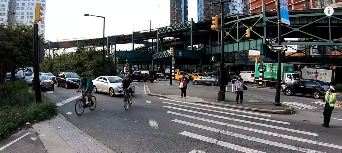
Complete streets
california Complete Streets act of 2008: the specific content of the law (read it here)
Assembly Bill No. 1358
CHAPTER 657
An act to amend Sections 65040.2 and 65302 of the Government Code, relating to planning.
[Approved by Governor September 30, 2008. Filed with Secretary of State September 30, 2008.]
legislative counsel’s digest
AB 1358, Leno. Planning: circulation element: transportation.
(1) Existing law requires the legislative body of each county and city to adopt a comprehensive, long-term general plan for the physical development of the county or city with specified elements, including a circulation element consisting of the general location and extent of existing and proposed major thoroughfares, transportation routes, terminals, any military airports and ports, and other local public utilities and facilities, all correlated with the land use element of the plan.
This bill would require, commencing January 1, 2011, that the legislative body of a city or county, upon any substantive revision of the circulation element of the general plan, modify the circulation element to plan for a balanced, multimodal transportation network that meets the needs of all users of streets, roads, and highways, defined to include motorists, pedestrians, bicyclists, children, persons with disabilities, seniors, movers of commercial goods, and users of public transportation, in a manner that is
suitable to the rural, suburban, or urban context of the general plan.
By requiring new duties of local officials, this bill would impose a state-mandated local program.
(2) Existing law establishes in the Office of the Governor the Office of Planning and Research with duties that include developing and adopting guidelines for the preparation of and content of mandatory elements required in city and county general plans.
This bill would require the office, commencing January 1, 2009, and no later than January 1, 2014, upon the next revision of these guidelines, to prepare or amend guidelines for a legislative body to accommodate the safe and convenient travel of users of streets, roads, and highways in a manner that is suitable to the rural, suburban, or urban context of the general plan, and in doing so to consider how appropriate accommodation varies depending on its transportation and land use context. It would authorize the office, in developing these guidelines, to consult with leading transportation experts, including, but not limited to, bicycle transportation planners, pedestrian planners, public transportation planners, local air quality management districts, and disability and senior mobility planners.
91
Ch. 657 — 2 --
(3) The California Constitution requires the state to reimburse local agencies and school districts for certain costs mandated by the state. Statutory provisions establish procedures for making that reimbursement.
This bill would provide that no reimbursement is required by this act for a specified reason.
The people of the State of California do enact as follows:
SECTION 1. This act shall be known and may be cited as the California Complete Streets Act of 2008.
SEC. 2. The Legislature finds and declares all of the following:
(a) The California Global Warming Solutions Act of 2006, enacted as Chapter 488 of the Statutes of 2006, sets targets for the reduction of greenhouse gas emissions in California to slow the onset of human-induced climate change.
(b) The State Energy Resources Conservation and Development Commission has determined that transportation represents 41 percent of total greenhouse gas emissions in California.
(c) According to the United States Department of Transportation’s 2001 National Household Travel Survey, 41 percent of trips in urban areas nationwide are two miles or less in length, and 66 percent of urban trips that are one mile or less are made by automobile.
(d) Shifting the transportation mode share from single passenger cars to public transit, bicycling, and walking must be a significant part of short- and long-term planning goals if the state is to achieve the reduction in the number of vehicle miles traveled and in greenhouse gas emissions required by current law.
(e) Walking and bicycling provide the additional benefits of improving public health and reducing treatment costs for conditions associated with reduced physical activity including obesity, heart disease, lung disease, and diabetes. Medical costs associated with physical inactivity were estimated by the State Department of Health Care Services to be $28 billion in 2005.
(f) TheCaliforniaBlueprintforBicyclingandWalking,preparedpursuant to the Supplemental Report of the Budget Act of 2001, sets the goal of a 50 percent increase in bicycling and walking trips in California by 2010, and states that to achieve this goal, bicycling and walking must be considered in land use and community planning, and in all phases of transportation planning and project design.
(g) Inordertofulfillthecommitmenttoreducegreenhousegasemissions, make the most efficient use of urban land and transportation infrastructure, and improve public health by encouraging physical activity, transportation planners must find innovative ways to reduce vehicle miles traveled and to shift from short trips in the automobile to biking, walking, and use of public transit.
(h) It is the intent of the Legislature to require in the development of the circulation element of a local government’s general plan that the circulation
91
— 3 — Ch. 657
of users of streets, roads, and highways be accommodated in a manner suitable for the respective setting in rural, suburban, and urban contexts, and that users of streets, roads, and highways include bicyclists, children, persons with disabilities, motorists, movers of commercial goods, pedestrians, public transportation, and seniors.
SEC. 3. Section 65040.2 of the Government Code is amended to read:
65040.2. (a) In connection with its responsibilities under subdivision (l) of Section 65040, the office shall develop and adopt guidelines for the preparation of and the content of the mandatory elements required in city and county general plans by Article 5 (commencing with Section 65300) of Chapter 3. For purposes of this section, the guidelines prepared pursuant to Section 50459 of the Health and Safety Code shall be the guidelines for the housing element required by Section 65302. In the event that additional elements are hereafter required in city and county general plans by Article 5 (commencing with Section 65300) of Chapter 3, the office shall adopt guidelines for those elements within six months of the effective date of the legislation requiring those additional elements.
(b) The office may request from each state department and agency, as it deems appropriate, and the department or agency shall provide, technical assistance in readopting, amending, or repealing the guidelines.
(c) The guidelines shall be advisory to each city and county in order to provide assistance in preparing and maintaining their respective general plans.
(d) The guidelines shall contain the guidelines for addressing environmental justice matters developed pursuant to Section 65040.12.
(e) The guidelines shall contain advice including recommendations for best practices to allow for collaborative land use planning of adjacent civilian and military lands and facilities. The guidelines shall encourage enhanced land use compatibility between civilian lands and any adjacent or nearby military facilities through the examination of potential impacts upon one another.
(f) The guidelines shall contain advice for addressing the effects of civilian development on military readiness activities carried out on all of the following:
(1) Military installations.
(2) Military operating areas.
(3) Military training areas.
(4) Military training routes.
(5) Military airspace.
(6) Other territory adjacent to those installations and areas.
(g) By March 1, 2005, the guidelines shall contain advice, developed in
consultation with the Native American Heritage Commission, for consulting with California Native American tribes for all of the following:
(1) The preservation of, or the mitigation of impacts to, places, features, and objects described in Sections 5097.9 and 5097.993 of the Public Resources Code.
91
Ch. 657 — 4 --
(2) Procedures for identifying through the Native American Heritage Commission the appropriate California Native American tribes.
(3) Proceduresforcontinuingtoprotecttheconfidentialityofinformation concerning the specific identity, location, character, and use of those places, features, and objects.
(4) Procedurestofacilitatevoluntarylandownerparticipationtopreserve and protect the specific identity, location, character, and use of those places, features, and objects.
(h) Commencing January 1, 2009, but no later than January 1, 2014, upon the next revision of the guidelines pursuant to subdivision (i), the office shall prepare or amend guidelines for a legislative body to accommodate the safe and convenient travel of users of streets, roads, and highways in a manner that is suitable to the rural, suburban, or urban context of the general plan, pursuant to subdivision (b) of Section 65302.
(1) In developing guidelines, the office shall consider how appropriate accommodation varies depending on its transportation and land use context, including urban, suburban, or rural environments.
(2) Theofficemayconsultwithleadingtransportationexpertsincluding, but not limited to, bicycle transportation planners, pedestrian planners, public transportation planners, local air quality management districts, and disability and senior mobility planners.
(i) The office shall provide for regular review and revision of the guidelines established pursuant to this section.
SEC. 4. Section 65302 of the Government Code is amended to read:
65302. The general plan shall consist of a statement of development policies and shall include a diagram or diagrams and text setting forth objectives, principles, standards, and plan proposals. The plan shall include the following elements:
(a) A land use element that designates the proposed general distribution and general location and extent of the uses of the land for housing, business, industry, open space, including agriculture, natural resources, recreation, and enjoyment of scenic beauty, education, public buildings and grounds, solid and liquid waste disposal facilities, and other categories of public and private uses of land. The location and designation of the extent of the uses of the land for public and private uses shall consider the identification of land and natural resources pursuant to paragraph (3) of subdivision (d). The land use element shall include a statement of the standards of population density and building intensity recommended for the various districts and other territory covered by the plan. The land use element shall identify and annually review those areas covered by the plan that are subject to flooding identified by flood plain mapping prepared by the Federal Emergency Management Agency (FEMA) or the Department of Water Resources. The land use element shall also do both of the following:
(1) Designate in a land use category that provides for timber production those parcels of real property zoned for timberland production pursuant to the California Timberland Productivity Act of 1982 (Chapter 6.7 (commencing with Section 51100) of Part 1 of Division 1 of Title 5).
91
— 5 — Ch. 657
(2) Consider the impact of new growth on military readiness activities carried out on military bases, installations, and operating and training areas, when proposing zoning ordinances or designating land uses covered by the general plan for land, or other territory adjacent to military facilities, or underlying designated military aviation routes and airspace.
(A) In determining the impact of new growth on military readiness activities, information provided by military facilities shall be considered. Cities and counties shall address military impacts based on information from the military and other sources.
(B) The following definitions govern this paragraph:
(i) “Military readiness activities” mean all of the following:
(I) Training, support, and operations that prepare the men and women
of the military for combat.
(II) Operation, maintenance, and security of any military installation. (III) Testing of military equipment, vehicles, weapons, and sensors for
proper operation or suitability for combat use.
(ii) “Militaryinstallation”meansabase,camp,post,station,yard,center,
homeport facility for any ship, or other activity under the jurisdiction of the United States Department of Defense as defined in paragraph (1) of subsection (e) of Section 2687 of Title 10 of the United States Code.
(b) (1) Acirculationelementconsistingofthegenerallocationandextent of existing and proposed major thoroughfares, transportation routes, terminals, any military airports and ports, and other local public utilities and facilities, all correlated with the land use element of the plan.
(2) (A) Commencing January 1, 2011, upon any substantive revision of the circulation element, the legislative body shall modify the circulation element to plan for a balanced, multimodal transportation network that meets the needs of all users of streets, roads, and highways for safe and convenient travel in a manner that is suitable to the rural, suburban, or urban context of the general plan.
(B) Forpurposesofthisparagraph,“usersofstreets,roads,andhighways” means bicyclists, children, persons with disabilities, motorists, movers of commercial goods, pedestrians, users of public transportation, and seniors.
(c) A housing element as provided in Article 10.6 (commencing with Section 65580).
(d) (1) A conservation element for the conservation, development, and utilization of natural resources including water and its hydraulic force, forests, soils, rivers and other waters, harbors, fisheries, wildlife, minerals, and other natural resources. The conservation element shall consider the effect of development within the jurisdiction, as described in the land use element, on natural resources located on public lands, including military installations. That portion of the conservation element including waters shall be developed in coordination with any countywide water agency and with all district and city agencies, including flood management, water conservation, or groundwater agencies that have developed, served, controlled, managed, or conserved water of any type for any purpose in the county or city for which the plan is prepared. Coordination shall include
91
Ch. 657 — 6 --
the discussion and evaluation of any water supply and demand information described in Section 65352.5, if that information has been submitted by the water agency to the city or county.
(2) The conservation element may also cover all of the following:
(A) The reclamation of land and waters.
(B) Prevention and control of the pollution of streams and other waters. (C) Regulation of the use of land in stream channels and other areas
required for the accomplishment of the conservation plan.
(D) Prevention, control, and correction of the erosion of soils, beaches,
and shores.
(E) Protection of watersheds.
(F) The location, quantity and quality of the rock, sand and gravel
resources.
(3) Upon the next revision of the housing element on or after January 1,
2009, the conservation element shall identify rivers, creeks, streams, flood corridors, riparian habitats, and land that may accommodate floodwater for purposes of groundwater recharge and stormwater management.
(e) An open-space element as provided in Article 10.5 (commencing with Section 65560).
(f) (1) A noise element that shall identify and appraise noise problems in the community. The noise element shall recognize the guidelines established by the Office of Noise Control and shall analyze and quantify, to the extent practicable, as determined by the legislative body, current and projected noise levels for all of the following sources:
(A) Highways and freeways.
(B) Primary arterials and major local streets.
(C) Passenger and freight on-line railroad operations and ground rapid
transit systems.
(D) Commercial,generalaviation,heliport,helistop,andmilitaryairport
operations, aircraft overflights, jet engine test stands, and all other ground facilities and maintenance functions related to airport operation.
(E) Local industrial plants, including, but not limited to, railroad classification yards.
(F) Other ground stationary noise sources, including, but not limited to, military installations, identified by local agencies as contributing to the community noise environment.
(2) Noise contours shall be shown for all of these sources and stated in terms of community noise equivalent level (CNEL) or day-night average level (Ldn). The noise contours shall be prepared on the basis of noise monitoring or following generally accepted noise modeling techniques for the various sources identified in paragraphs (1) to (6), inclusive.
(3) The noise contours shall be used as a guide for establishing a pattern of land uses in the land use element that minimizes the exposure of community residents to excessive noise.
(4) Thenoiseelementshallincludeimplementationmeasuresandpossible solutions that address existing and foreseeable noise problems, if any. The
91
— 7 — Ch. 657
adopted noise element shall serve as a guideline for compliance with the state’s noise insulation standards.
(g) (1) A safety element for the protection of the community from any unreasonable risks associated with the effects of seismically induced surface rupture, ground shaking, ground failure, tsunami, seiche, and dam failure; slope instability leading to mudslides and landslides; subsidence, liquefaction, and other seismic hazards identified pursuant to Chapter 7.8 (commencing with Section 2690) of Division 2 of the Public Resources Code, and other geologic hazards known to the legislative body; flooding; and wildland and urban fires. The safety element shall include mapping of known seismic and other geologic hazards. It shall also address evacuation routes, military installations, peakload water supply requirements, and minimum road widths and clearances around structures, as those items relate to identified fire and geologic hazards.
(2) The safety element, upon the next revision of the housing element on or after January 1, 2009, shall also do the following:
(A) Identify information regarding flood hazards, including, but not limited to, the following:
(i) Flood hazard zones. As used in this subdivision, “flood hazard zone” means an area subject to flooding that is delineated as either a special hazard area or an area of moderate or minimal hazard on an official flood insurance rate map issued by the Federal Emergency Management Agency. The identification of a flood hazard zone does not imply that areas outside the flood hazard zones or uses permitted within flood hazard zones will be free from flooding or flood damage.
(ii) National Flood Insurance Program maps published by FEMA.
(iii) Information about flood hazards that is available from the United States Army Corps of Engineers.
(iv) DesignatedfloodwaymapsthatareavailablefromtheCentralValley Flood Protection Board.
(v) Dam failure inundation maps prepared pursuant to Section 8589.5 that are available from the Office of Emergency Services.
(vi) Awareness Floodplain Mapping Program maps and 200-year flood plain maps that are or may be available from, or accepted by, the Department of Water Resources.
(vii) Maps of levee protection zones.
(viii) Areas subject to inundation in the event of the failure of project or nonproject levees or floodwalls.
(ix) Historicaldataonflooding,includinglocallypreparedmapsofareas that are subject to flooding, areas that are vulnerable to flooding after wildfires, and sites that have been repeatedly damaged by flooding.
(x) Existing and planned development in flood hazard zones, including structures, roads, utilities, and essential public facilities.
(xi) Local, state, and federal agencies with responsibility for flood protection, including special districts and local offices of emergency services. (B) Establishasetofcomprehensivegoals,policies,andobjectivesbased on the information identified pursuant to subparagraph (A), for the protection
91
Ch. 657 — 8 --
of the community from the unreasonable risks of flooding, including, but not limited to:
(i) Avoiding or minimizing the risks of flooding to new development.
(ii) Evaluating whether new development should be located in flood hazard zones, and identifying construction methods or other methods to minimize damage if new development is located in flood hazard zones.
(iii) Maintainingthestructuralandoperationalintegrityofessentialpublic facilities during flooding.
(iv) Locating, when feasible, new essential public facilities outside of flood hazard zones, including hospitals and health care facilities, emergency shelters, fire stations, emergency command centers, and emergency communications facilities or identifying construction methods or other methods to minimize damage if these facilities are located in flood hazard zones.
(v) Establishingcooperativeworkingrelationshipsamongpublicagencies with responsibility for flood protection.
(C) Establishasetoffeasibleimplementationmeasuresdesignedtocarry out the goals, policies, and objectives established pursuant to subparagraph (B).
(3) After the initial revision of the safety element pursuant to paragraph (2), upon each revision of the housing element, the planning agency shall review and, if necessary, revise the safety element to identify new information that was not available during the previous revision of the safety element.
(4) Citiesandcountiesthathavefloodplainmanagementordinancesthat have been approved by FEMA that substantially comply with this section, or have substantially equivalent provisions to this subdivision in their general plans, may use that information in the safety element to comply with this subdivision, and shall summarize and incorporate by reference into the safety element the other general plan provisions or the flood plain ordinance, specifically showing how each requirement of this subdivision has been met.
(5) Prior to the periodic review of its general plan and prior to preparing or revising its safety element, each city and county shall consult the California Geological Survey of the Department of Conservation, the Central Valley Flood Protection Board, if the city or county is located within the boundaries of the Sacramento and San Joaquin Drainage District, as set forth in Section 8501 of the Water Code, and the Office of Emergency Services for the purpose of including information known by and available to the department, the office, and the board required by this subdivision.
(6) To the extent that a county’s safety element is sufficiently detailed and contains appropriate policies and programs for adoption by a city, a city may adopt that portion of the county’s safety element that pertains to the city’s planning area in satisfaction of the requirement imposed by this subdivision.
SEC. 5. No reimbursement is required by this act pursuant to Section 6 of Article XIII B of the California Constitution because a local agency or
91
— 9 — Ch. 657
school district has the authority to levy service charges, fees, or assessments sufficient to pay for the program or level of service mandated by this act, within the meaning of Section 17556 of the Government Code.