
|
|

MARIN COUNTY ON-CALL SERVICES
|
COMMENTARY ON IMPROVEMENTS BY GRANT JOHNSON, TE :
|

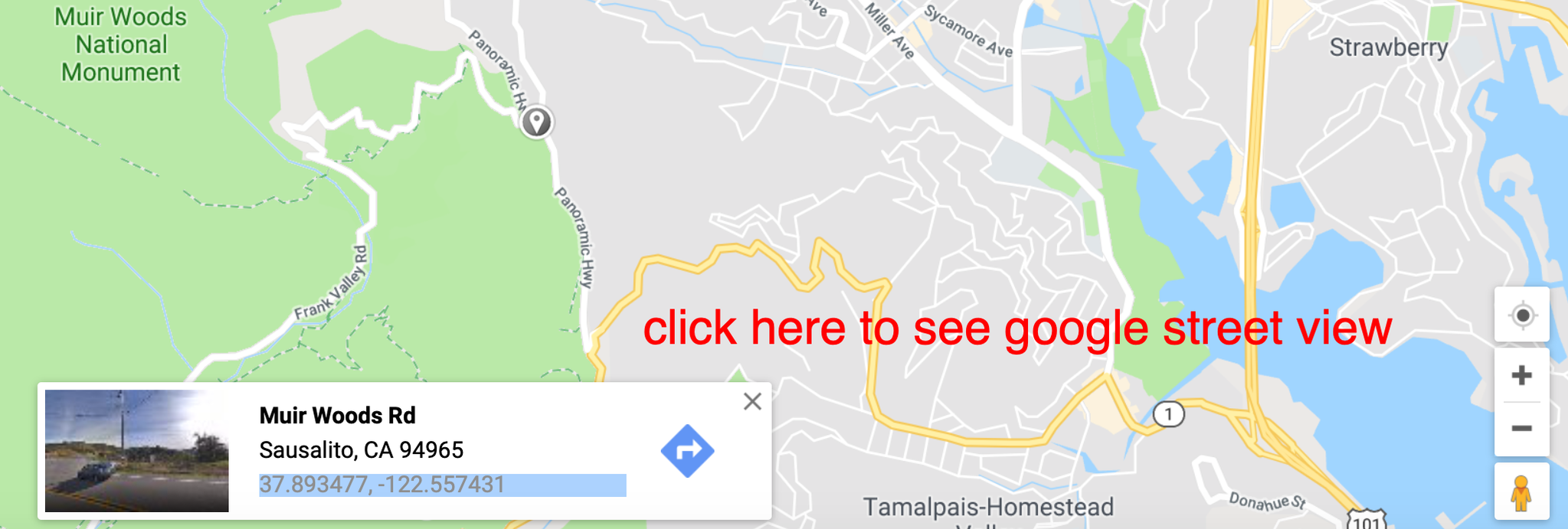
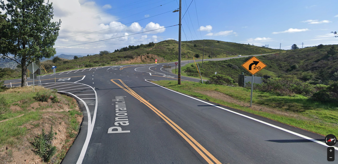
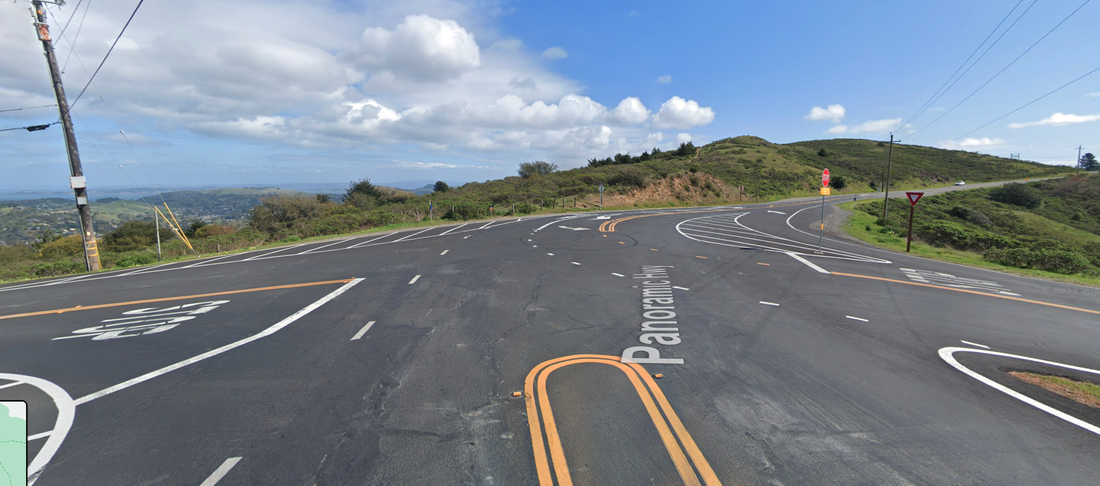
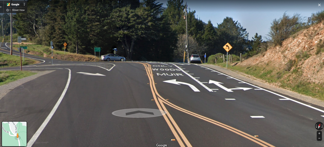
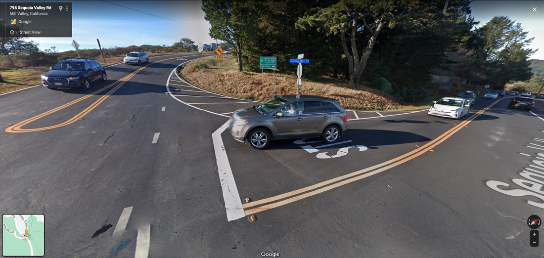
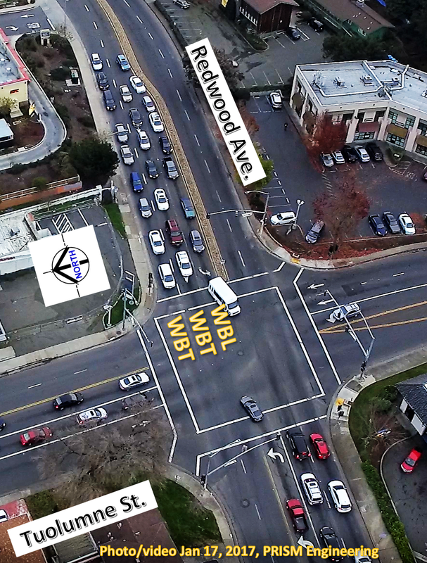
Google Street View UPDATES to Four Corners Intersection Final Alternative (Photos Mar 2021).
Designed Jan 2019, Constructed 2021 based on PRISM Engineering Design
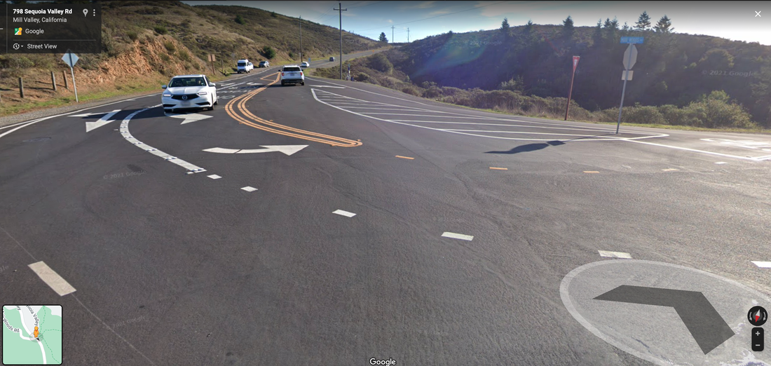
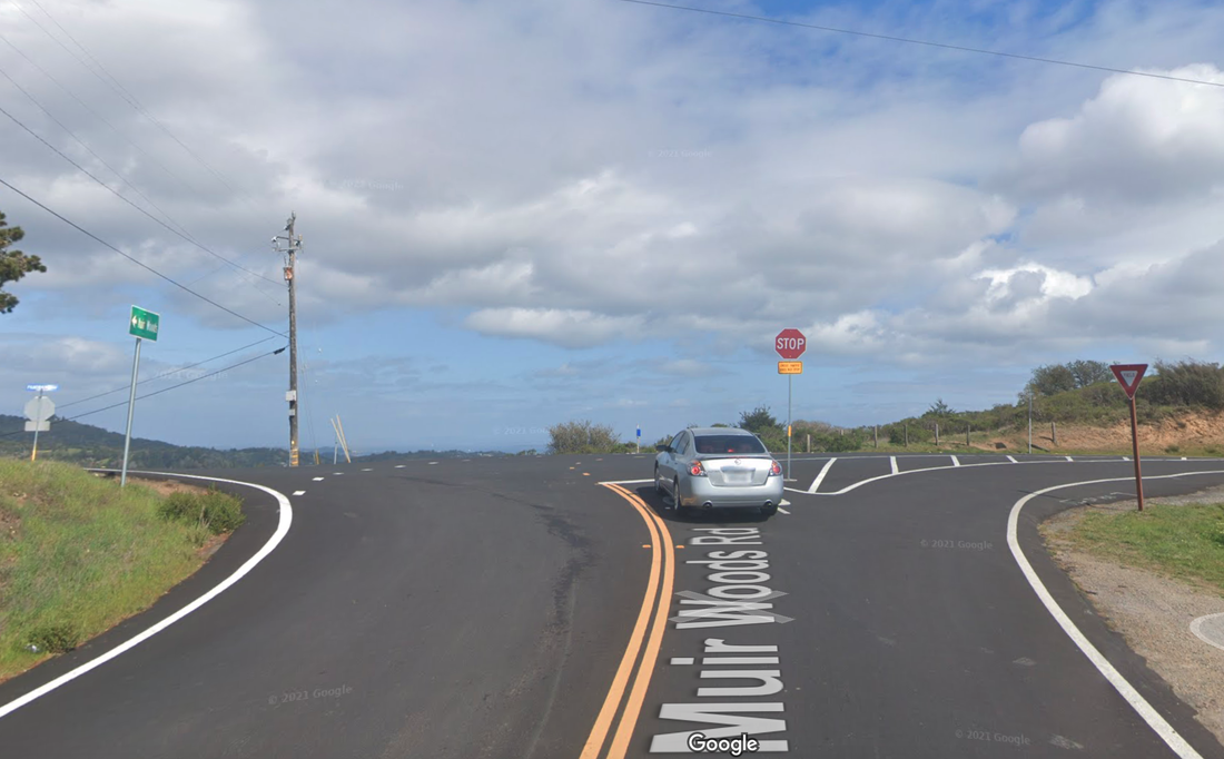
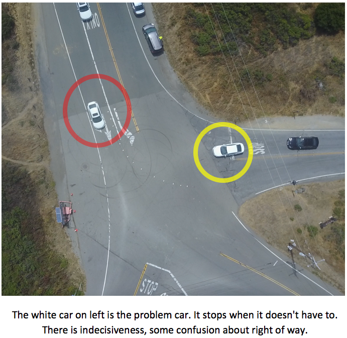
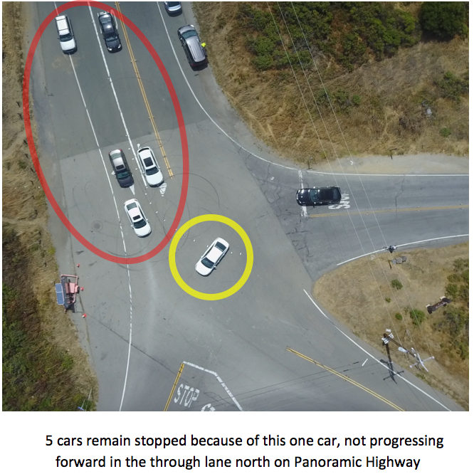
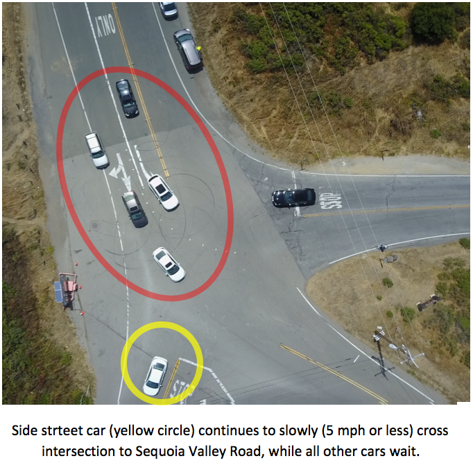
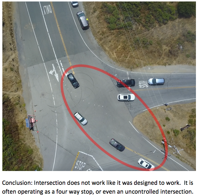
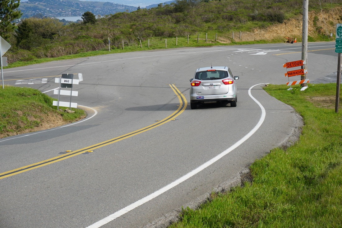
This was the "Before Improvement" traffic operations safety problem at this intersection.
video © 2019 PRISM Engineering
Transportation Planning SAMPLES by PRISM Engineering
Traffic Impact Studies, Traffic Demand Models, Multimodal Corridor Studies, Transit Studies, Roundabouts
EMERGENCY RESPONSE! Fire Engine Response Study. Feb 2019, Fairfield, CA
|
photo/video © 2019 PRISM Engineering
|
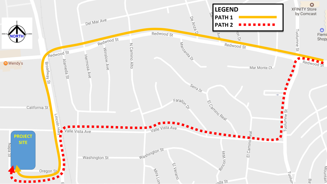
PRISM Engineering conducted a comprehensive emergency fire engine response time study to determine if adequate emergency response times are in place according to established standards (NFPA 1710). Out of nine nearby fire stations, 3 were within the standards, and only one needed to be. A complete report with tables and graphics was prepared to document all findings, and detailed times on all travel paths. Google Maps App was also researched to make comparisons of actual drive times in the field, and to verify. The purpose of the study was to find out through engineering methods (research, measurements, analysis, and summary) what fire engine response times from various fire stations proximate to the project site would be, by physically measuring and video recording actual driving times from each station to the site, adjusting times for red lights along the way, considering the effects of traffic congestion, and taking into consideration what happens when a fire engine deploys traffic signal pre-emption to bypass a red light at an intersection, etc. In addition, “big data” from Google Maps was also used, a publicly available data set that documents the ranges of time that drivers experienced along a certain path while using the Google Maps App. A detailed info-graphic and summary matrix and report were prepared to show optimum pathways and times from nine different nearby fire stations to the project site, during the “worst case” pm peak hour time period.
|
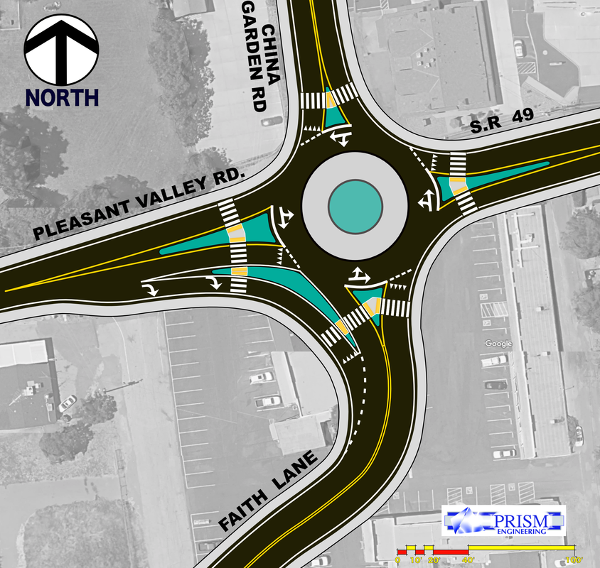
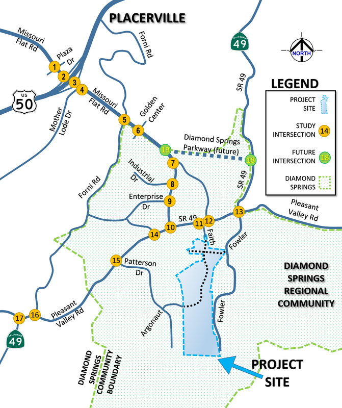
ROUNDABOUT in 2018/2019-- In El Dorado County: Dorado Oaks Residential Development in Diamond Springs UPDATE: Traffic Impact Study and Operations Analysis and |
|
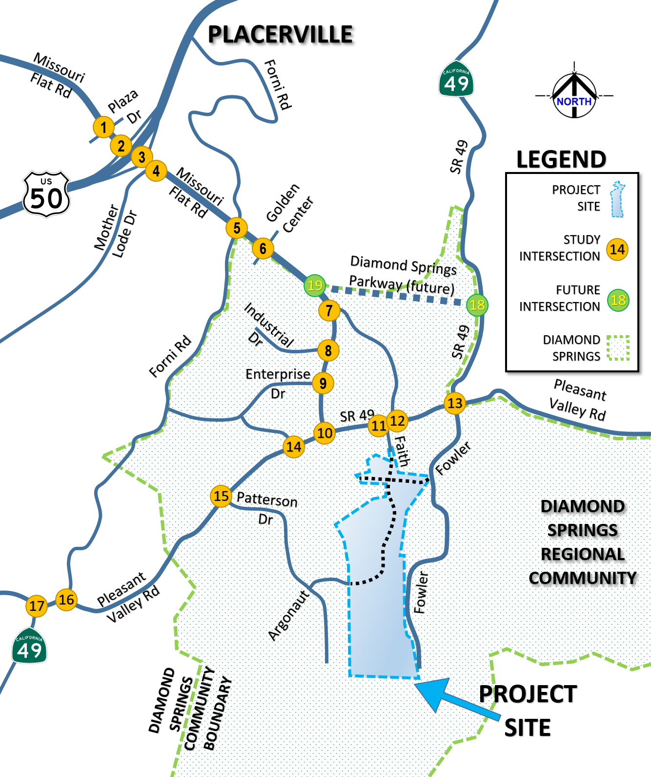
This study includes a comprehensive Traffic Impact Study, a Traffic Operations Analysis and Micro-simulation model(s) for the Missouri Flat Road corridor from Plaza Drive to SR 49 Pleasant Valley Road (2 miles). Multiple scenarios were analyzed for Year 2017, 2025, and 2035 conditions with and without the project. Detailed analyses were performed using calibrated micro-simulation SimTraffic models, and mitigation measures explored along with the future Diamond Springs Parkway bypass in the Travel Demand Model network.

|
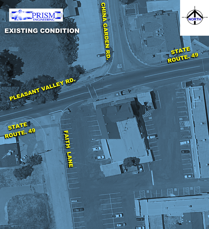
FIG 1: Existing Condition lacking capacity, intersections too close and narrow to mitigate. |

FIG 2: Proposed Roundabout solves capacity, speed, geometry, and LOS for Project Expansion |
Project is 400 Residential Dwelling Units
Coming up with solutions for this study was particularly challenging:
1) There is a new bypass that will change traffic patterns in the future.
2) There is a narrow historical road which serves as State Highway 49 which can't be expanded or signalized easily. So a roundabout solution was sought to preserve the historical buildings, prevent widening, and keep speeds reasonably slow and safe.
3) Access issues abound where driveways are numerous and sidewalks are not installed.
4) Bike lanes are missing because of narrow roads and right of way issues
5) New development is required to find more connectivity between neighborhoods, and minimize impacts by encouraging walking, biking, and use of transit where possible.
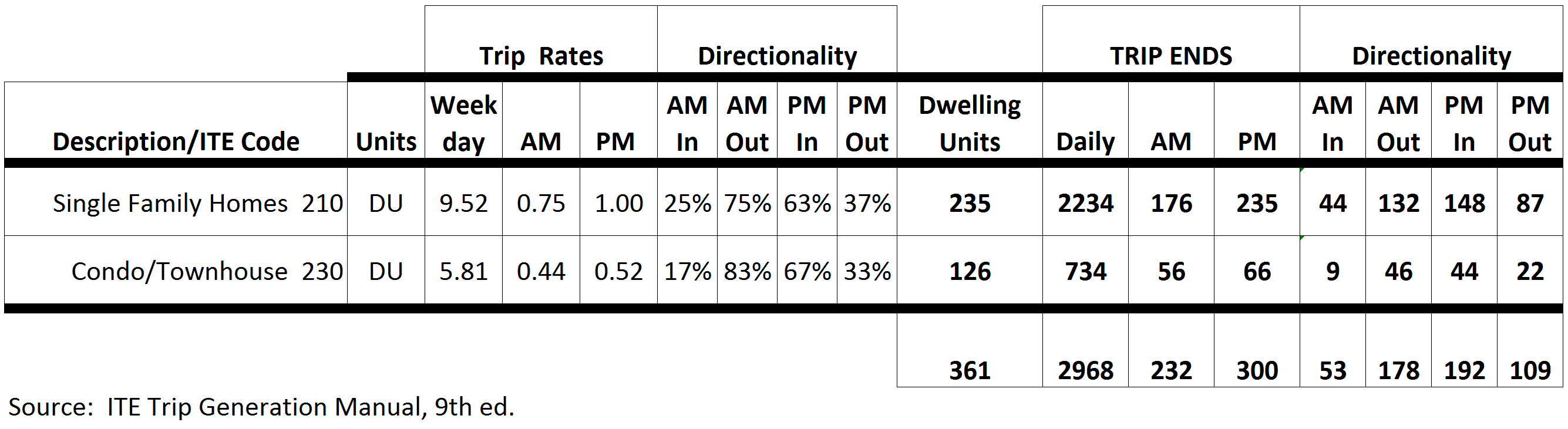
Year 2019 Trip Generation and Traffic Patterns Study: understanding traffic characteristics, trip generation
At PRISM Engineering, we build a solid baseline of existing conditions to establish traffic patterns, then build on that and analyze the future...
photo/video © 2019 PRISM Engineering

|
Working with the United States Attorney's Office in the Department of Justice, Mr. Johnson was retained to perform Expert Witness Traffic Engineering review of an accident case, including field review, examination of roadway traffic control devices and compliance with relevant Federal documents such as MUTCD*, deposition, court testimony.
*MUTCD=Manual of Uniform Traffic Control Devices, FHWA photo/video © 2019 PRISM Engineering |

|
|
-ON-CALL SERVICES-
|
In the City of Vacaville: The Farm at Alamo Creek TIA (2017-2018)
| ||||

|
| ||

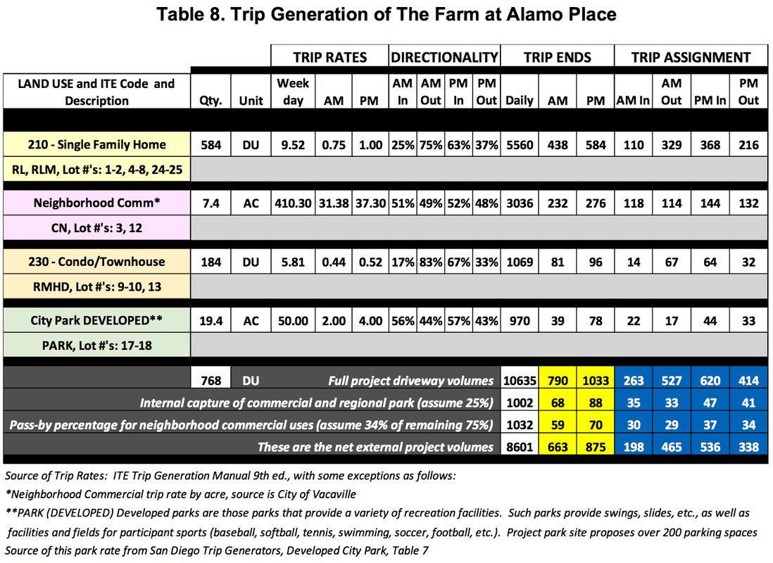
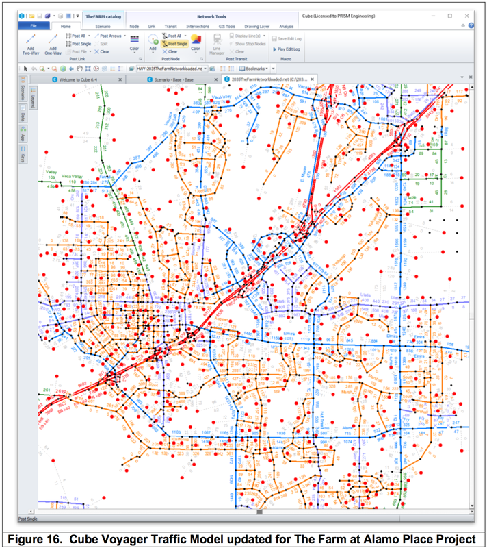
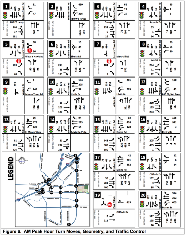
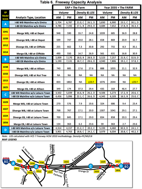

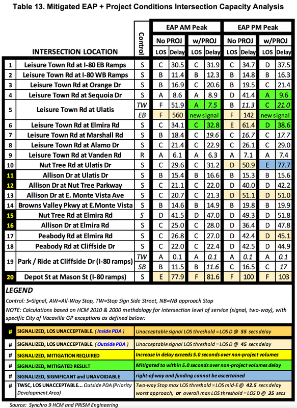

Report Samples. Trip Generation. CUBE 6.4 Traffic Demand Model. Excel Database. Synchro HCM Analysis. Mitigations
-ON-CALL SERVICES-
|
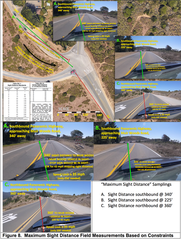
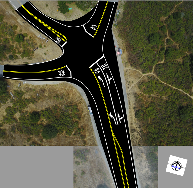
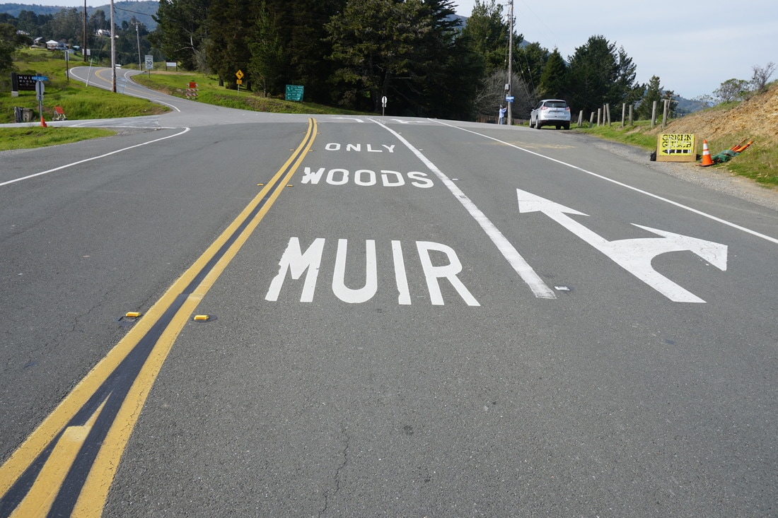
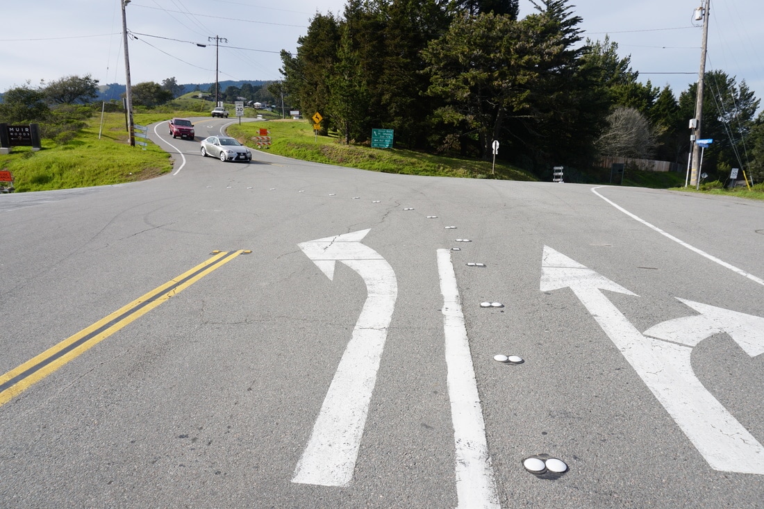
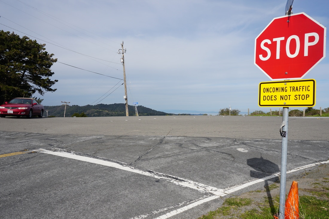
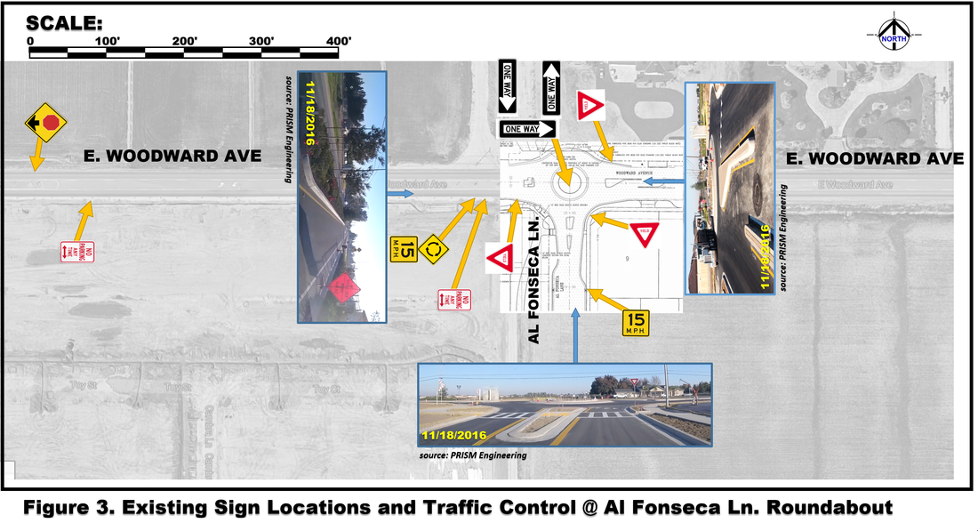
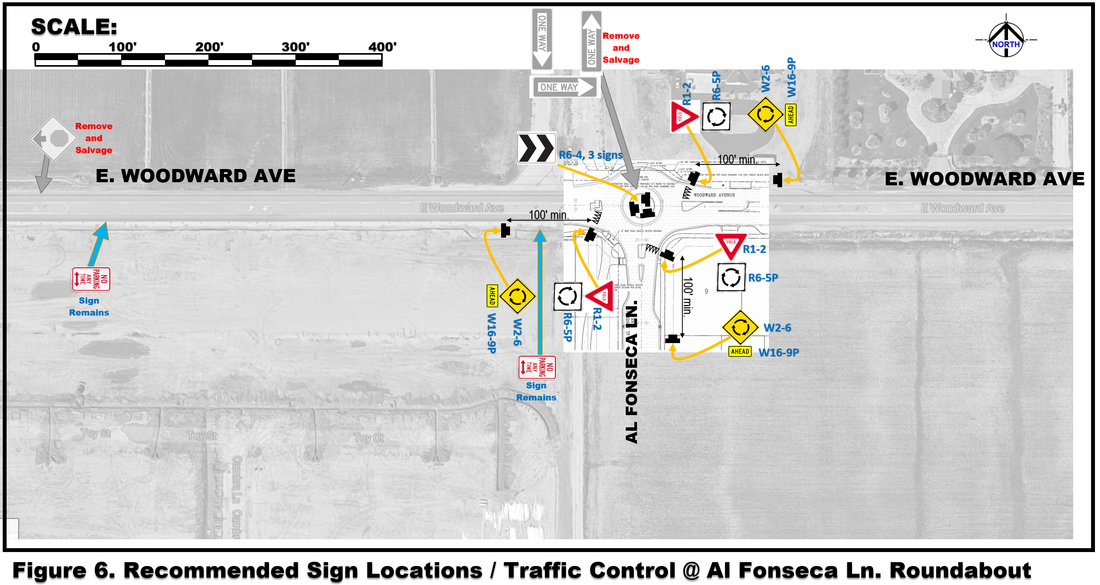
In Marin County: Four Corners Intersection Improvements (2017)
| ||||

|
| ||
photos © 2019 PRISM Engineering
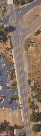
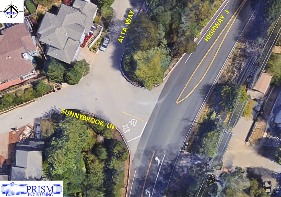
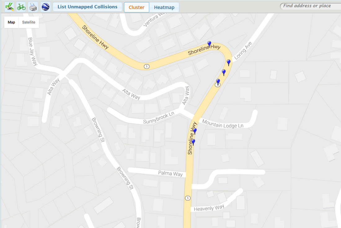
SIGHT DISTANCE and SPEED STUDIES
|
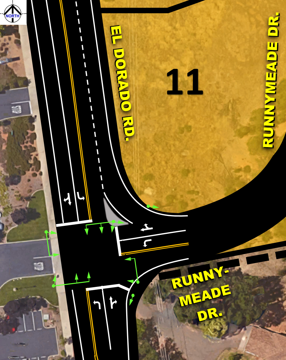
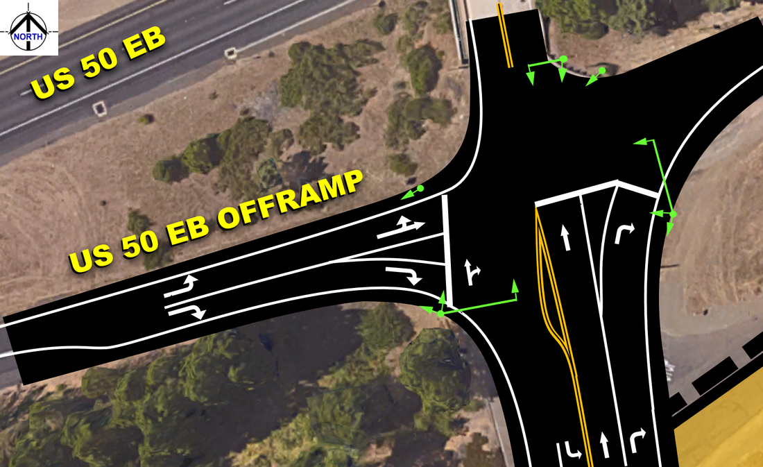
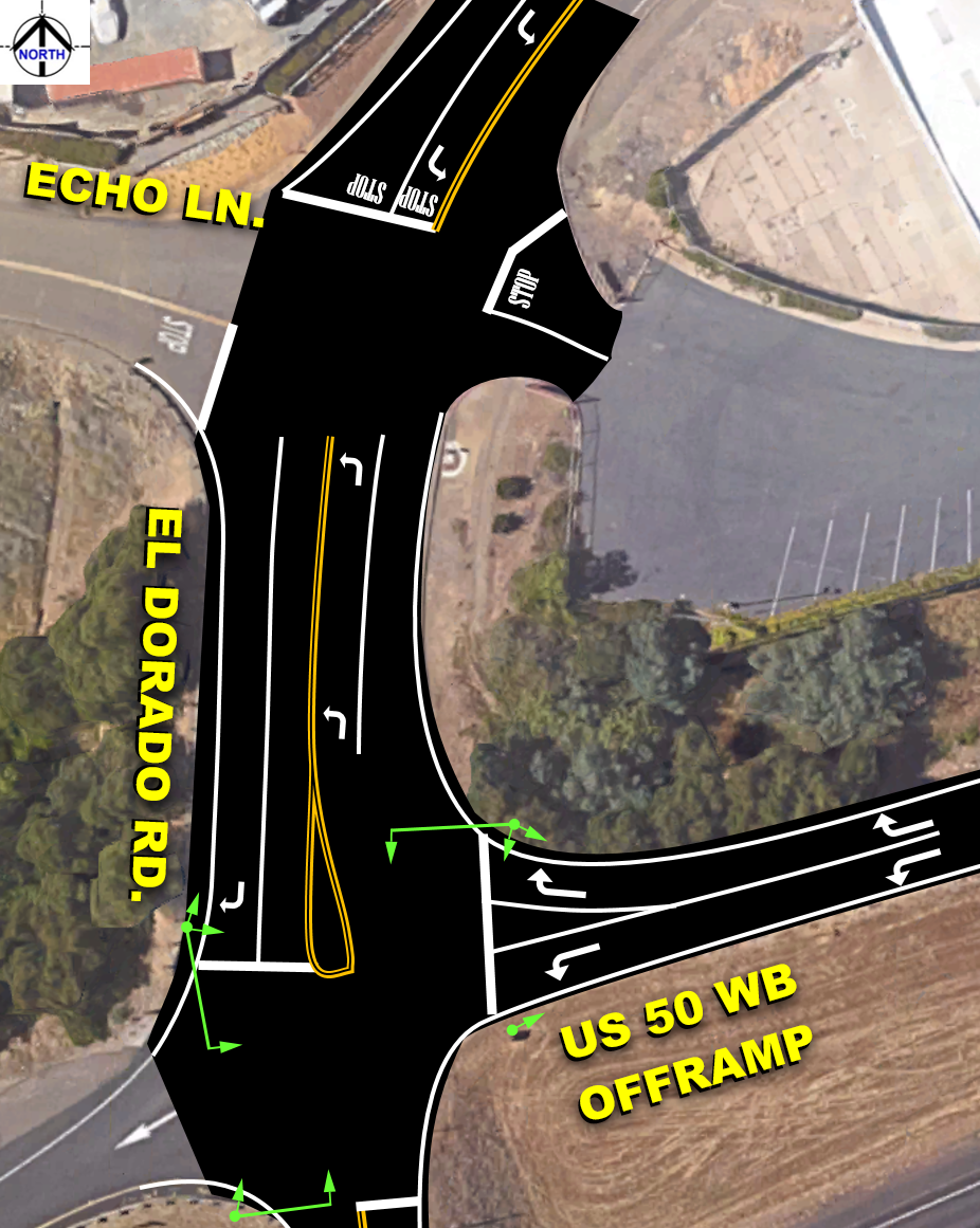
AERIAL VIEWS and NEW INTERSECTION DESIGN
|


|
|
Report Files

|
|
|
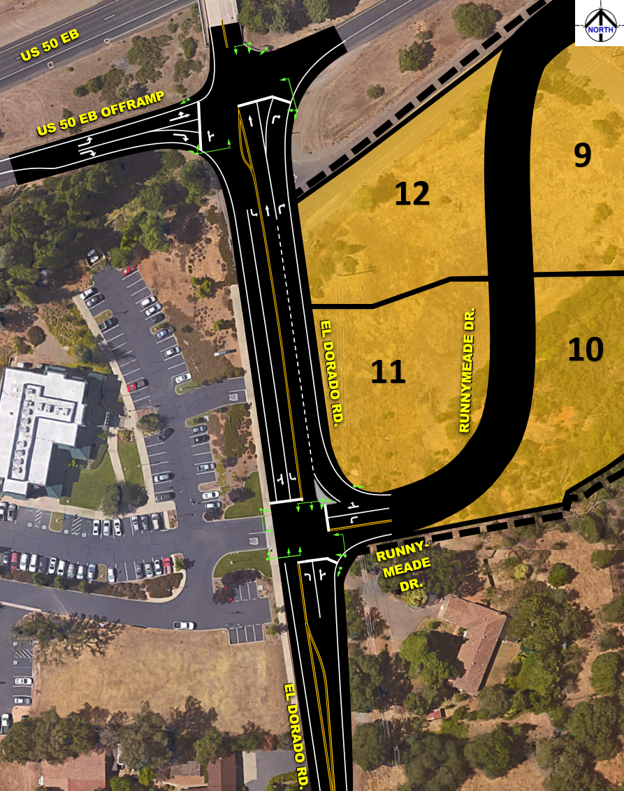
This study includes a Traffic Impact Study, a Traffic Operations Analysis and Micro-simulation model(s) for the El Dorado Road corridor from Echo Lane to Runnymeade Drive realigned. Coordinated signal system. Multiple scenarios were analyzed for Year 2017, 2025, and 2035 conditions with and without the project. Detailed analyses were performed using calibrated micro-simulation SimTraffic models, and mitigation measures explored along with the future Diamond Springs Parkway bypass in the Travel Demand Model network. |

|
In El Dorado County: Stonehenge Springs Residential Development in Diamond Springs Traffic Impact Study and Operations Analysis (2016/17)This study includes a comprehensive Traffic Impact Study, a Traffic Operations Analysis and Micro-simulation model(s) for the Missouri Flat Road corridor from Plaza Drive to SR 49 Pleasant Valley Road (2 miles). Multiple scenarios were analyzed for Year 2017, 2025, and 2035 conditions with and without the project. Detailed analyses were performed using calibrated micro-simulation SimTraffic models, and mitigation measures explored along with the future Diamond Springs Parkway bypass in the Travel Demand Model network.
|

|
|

|
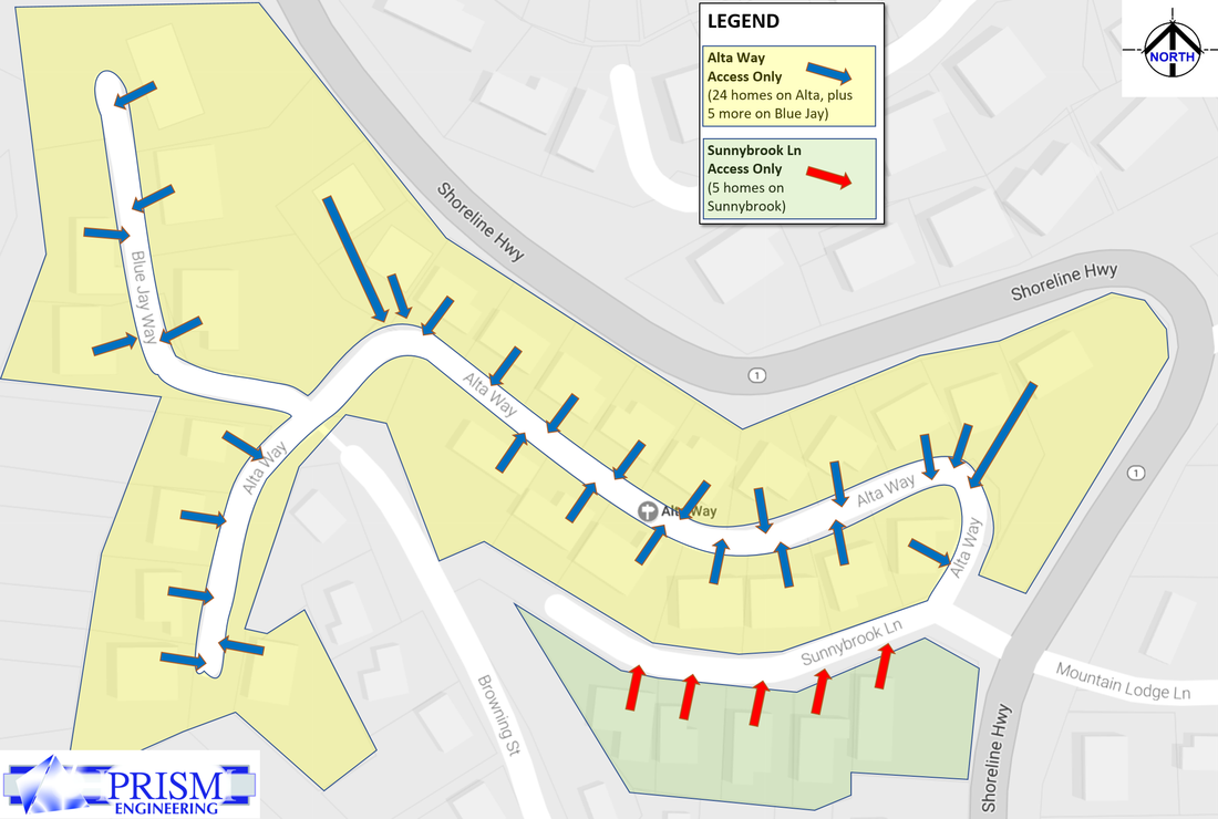
In Marin County: Alta Way Peer Review (2017)Examining Traffic Conditions (level of service, speeds, sight distance, left turn pocket lengths, trip generation, etc) for new residential development on Alta Lane extension. Peer Review of pre-existing traffic studies. Working as sub-consultant to Sicular Environmental Consulting and Natural Lands Management under contract with Marin County.
|

|
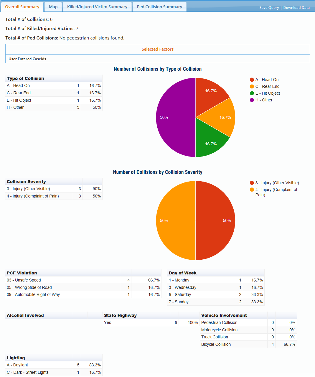
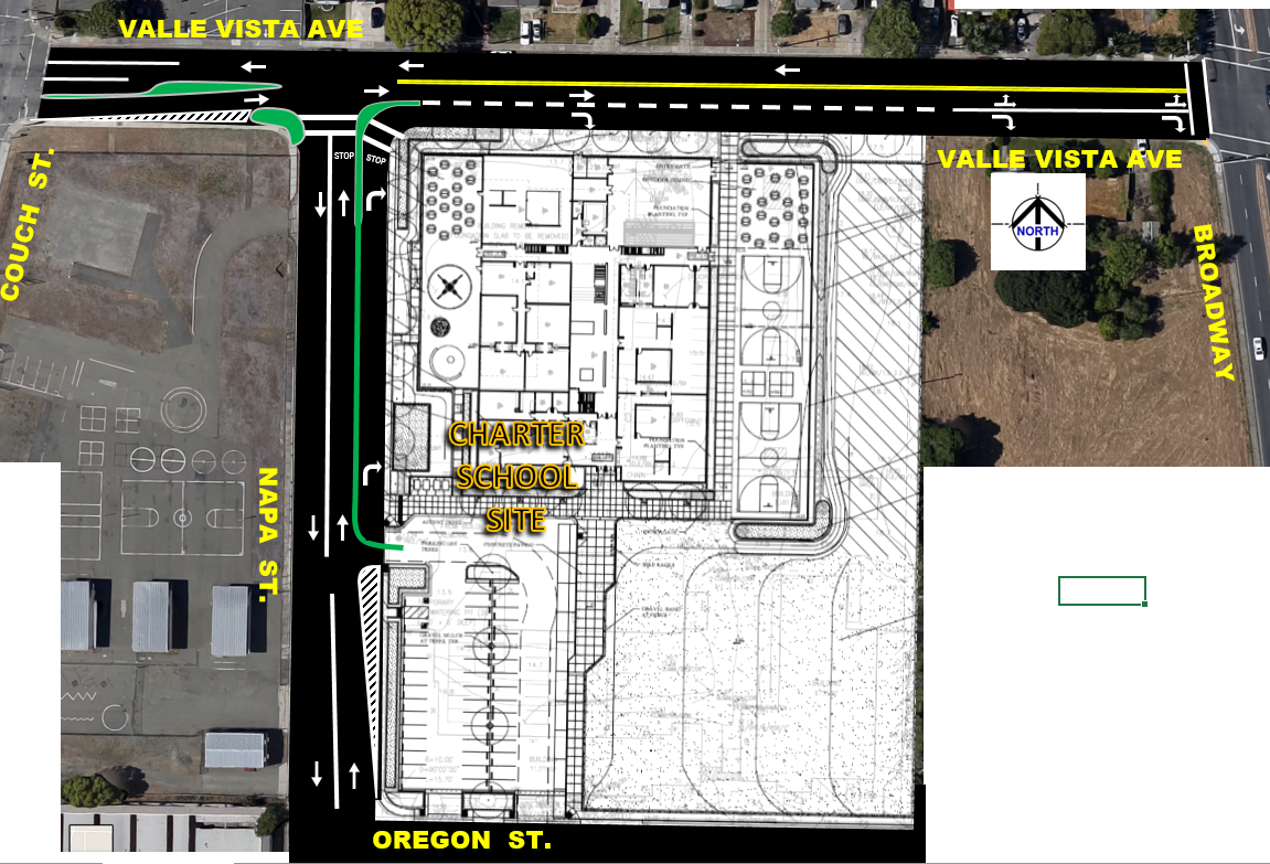
In City of Vallejo: Caliber Charter School Traffic Impact Study and Follow-up Intersection Mitigation Alternatives Development and Analyses (2016/17)Worked with City of Vallejo Staff to develop workable circulation and student arrival solutions to minimize queues and impacts to local streets and intersections. Developed custom traffic control plan for neighborhood. Developed trip generation scenarios based on TDM plan for staggered start times of classes at Charter School. Ran analysis scenarios for Year 2016, 2026, and 2035 using traffic model output from Solano Transit Authority travel demand model. Collected new traffic for wide region of intersections.
|
|


|
In Marin County: Expert Witness Review of MUTCD and Highway Design Manual Compliance (2017) |


|
In City of Manteca: Roundabout Installation, Expert Witness Review (2017)
|


|
In Marin County: On-Call Traffic Engineering Services Contract with Department of Public Works (2017) |
|
|

|
In City of Lincoln: On-Call Traffic Engineering Services Contract (2016/17)
|

|

|
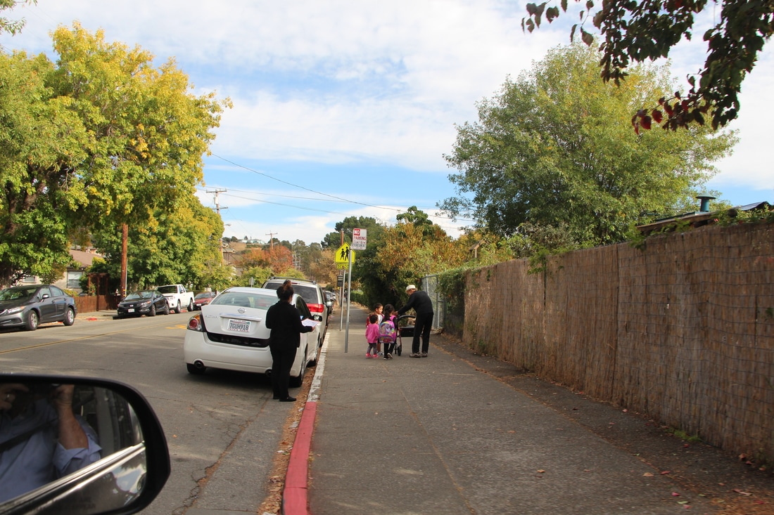
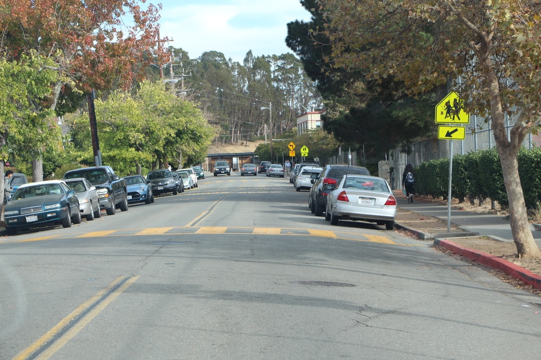
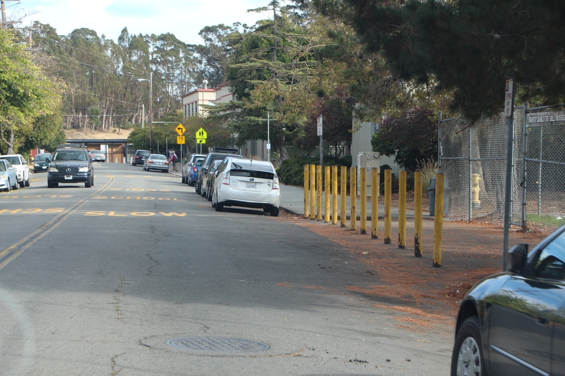
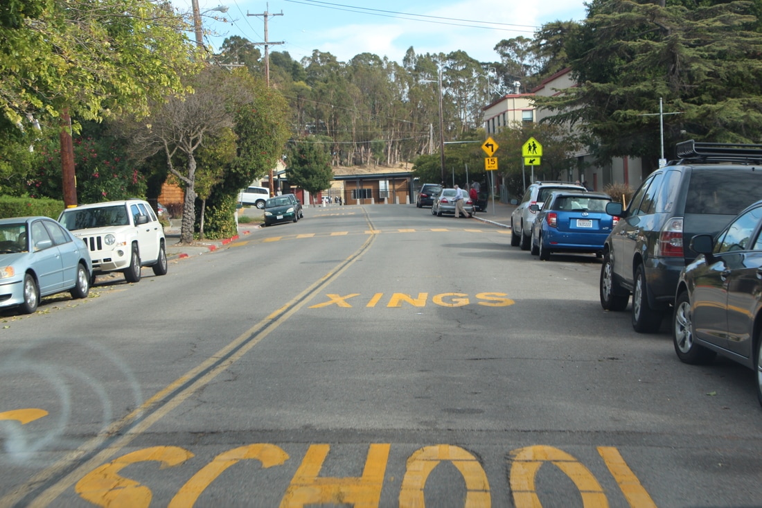
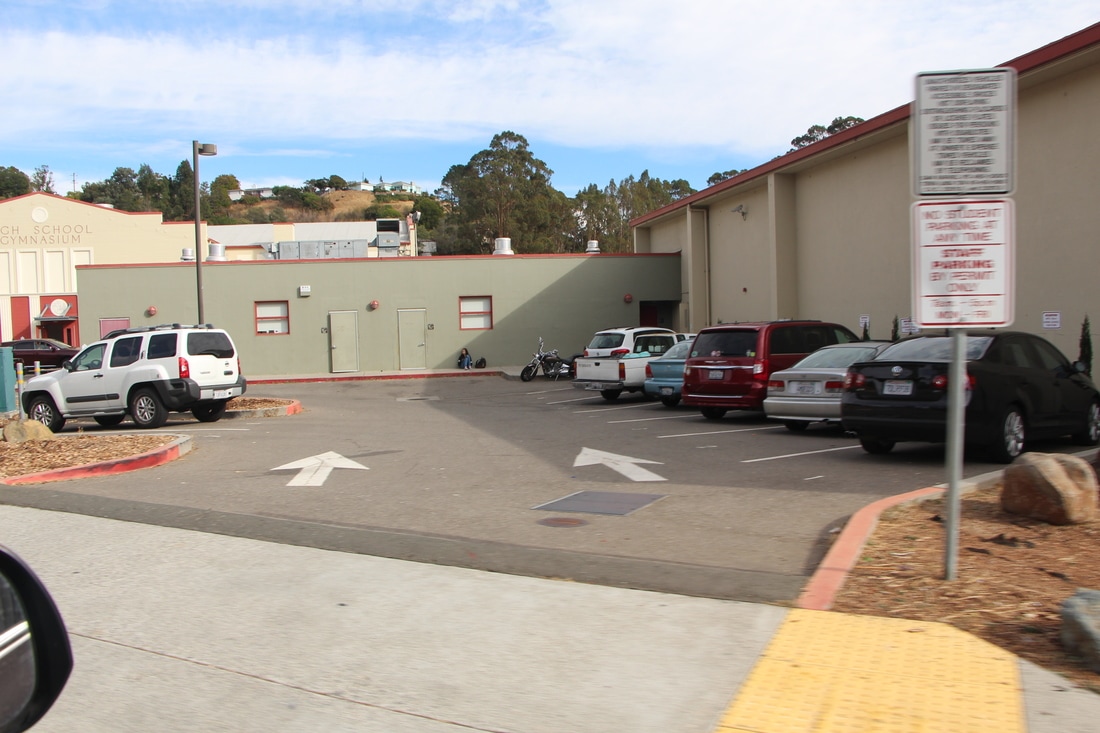
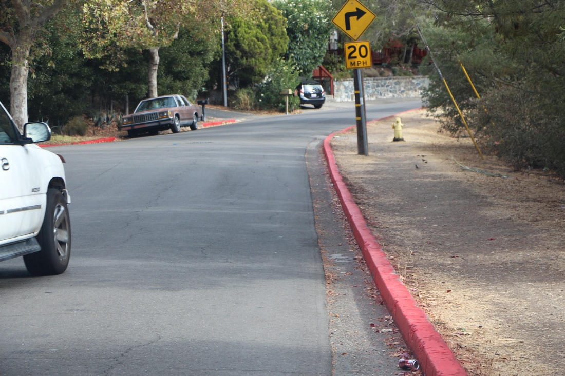
In City of San Rafael: Safe Routes to School Field Review and Analysis of Multi-modal Traffic and Ped conditions.
|
|
Extensive Capacity Analysis for High School Alternatives. Reviewing parking lot situations for high school expansion. Extensive review of on-street parking impacts existing and future expansions. Pedestrian and vehicle flow analyses for surrounding neighborhoods. Develop solutions to reduce traffic impacts, reduce impacts to local neighborhoods, and Improve safety for children walking or biking to school.
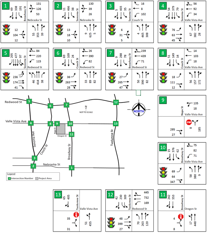
Conducted video surveys of existing traffic patterns and pedestrian travel patterns. Through video observations above and beyond the traffic count data, it was possible to observe critical traffic conflicts with both vehicles and pedestrians. It was possible to track origin and destination movements, giving a big picture understanding of transportation modes and movements. Examined condition of all installed Traffic Control Devices and recommended new installations where safety was an issue. Developed large scale graphics to provide big picture understanding. |
|

INFOGRAPHICS developed by Grant Johnson, TE to communicate big picture situations, team communications, report graphics

|
|
In the City of Vallejo: Charter School Traffic Study. Trip Generation Research. Synchro 9 Analysis. Microsimulation. Mitigation. Report.
|
|
| ||||
Other Studies Underway or Recently Completed |
|